
Page 33: Wakopa - The first “Stopping Place” for settlers heading west
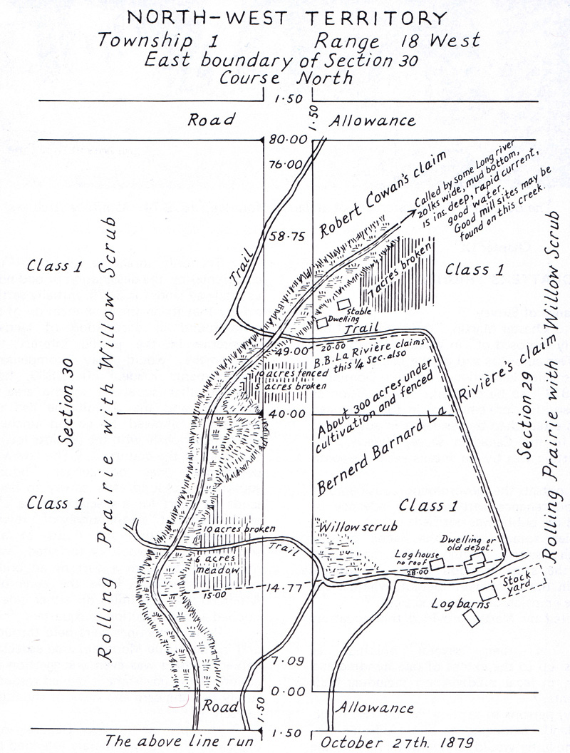
Wakopa was the first of the villages that were to pop up in the first few years of European settlement – before the arrival of the railway.
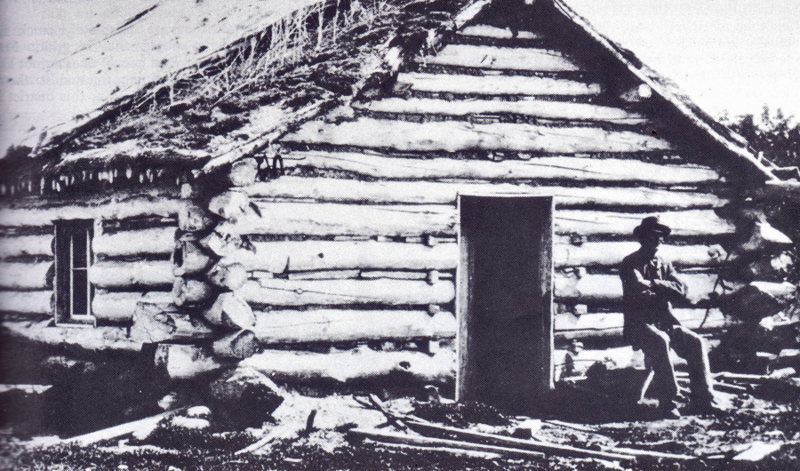
The LaRiviere House at Wakopa

Wakopa Cairn
Vantage Points Articles
Old Wakopa / Web / PDF
Vol. I , Page 42
Page 34: “Old” Desford.
This map shows post offices in 1884. Desford was on the map well before Boissevain.
Overlooking the second Desford site.
Page 35: The Cheese King
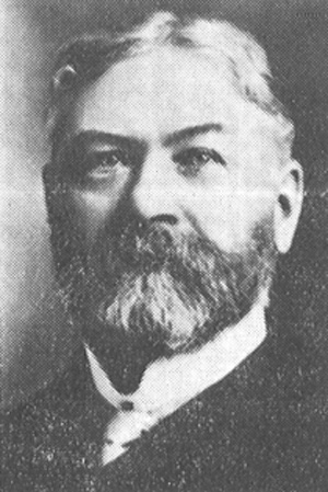
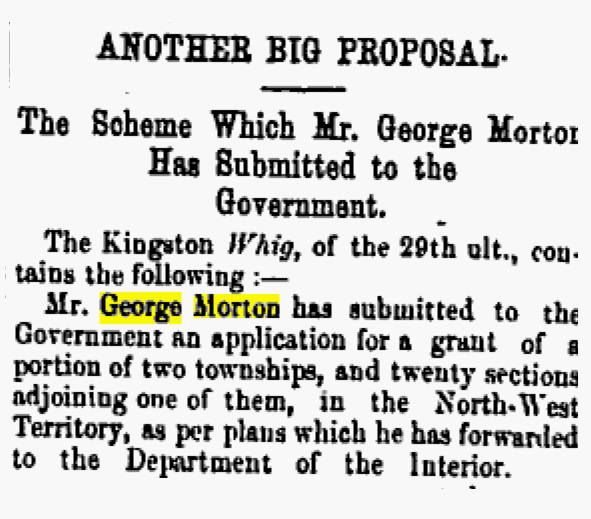 From the Winnipeg Times – May 5, 1881 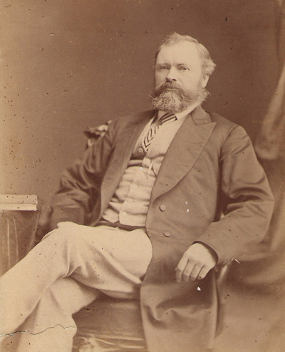 George Morton Mr. Morton however proceeded with his other businesses (stores, sawmills, and elevators) and did very well. The Municipality of Morton is named after him. 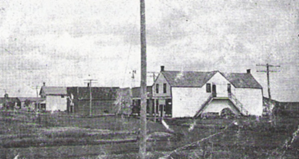 |
Page 36: Turtle Mountain City & Waubeesh
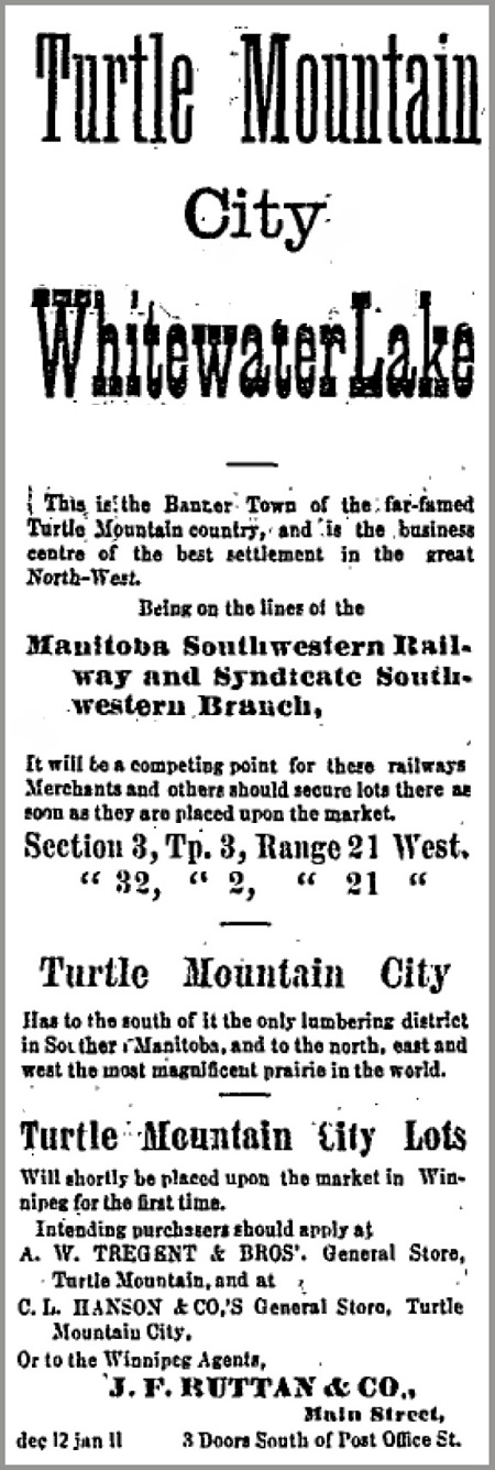
Winnipeg Times January 7, 1881
Ads like this one ran in Winnipeg newspapers regularly in 1881 and 1882.
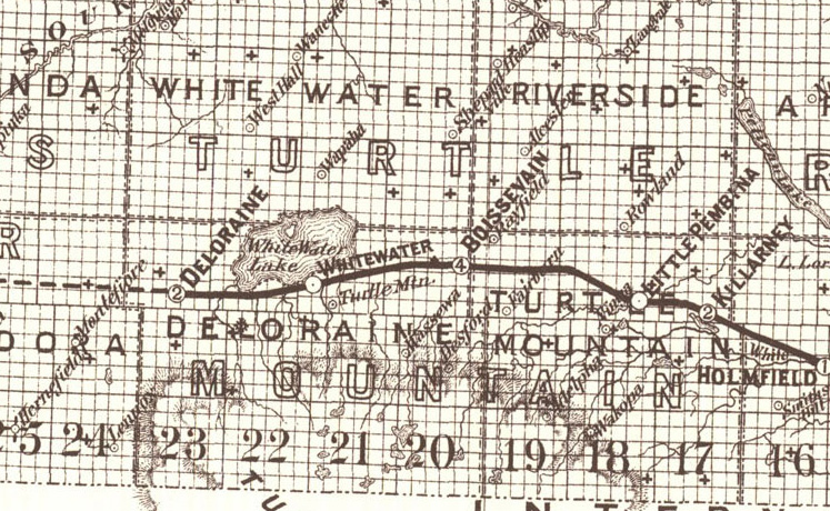
By the time the railway arrived in 1885, Turtle Mountain as it was then called was just a post office.
The railway passed to the north and the new town of Whitewater was created.
Vantage Points Articles
All Saint's Church Web / PDF
Vol. III, Page 34
Turtle Mountain City & Waubeesh
Web / PDF
Vol. I, Page 21
The English Settlement Web / PDF
Vol. IV, Page 38
Page 37: Old Deloraine

n 1880 the Dominion government established a Land Titles Office south of Turtle Mountain along the Commission Trail.
Today we call the location Newcombe’s Hollow, after George Newcombe, the man in charge.
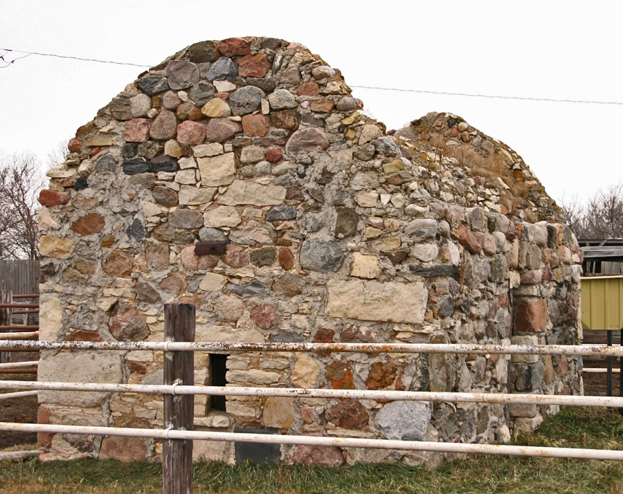

All that remains of “Old Deloraine” is this stone bank vault.
The rest of the village’s buildings were quickly moved to the new rail line a few kilometres away.
James Cavers was the first Postmaster in both “Old” and “New” Deloraine. He named the village after his old home in Scotland.
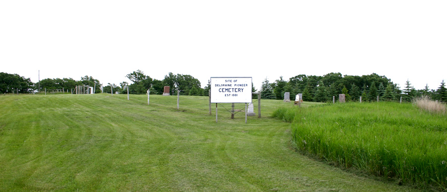
The Deloraine Pioneer Cemetery – still in use.
Vantage Points Articles
Old Deloraine Web / PDF
Vol. I, Page 24
Newcomb's Hollow: Old Deloraine Land Titles Office Web / PDF
Vol.I, Page 23
Mary Hathway's Homestead Web / PDF
Vol. IV, Page 34
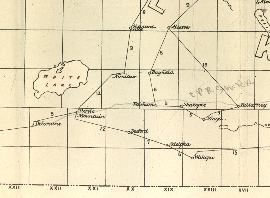
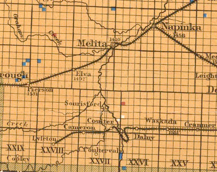
Page 38: Melgund & Hartney
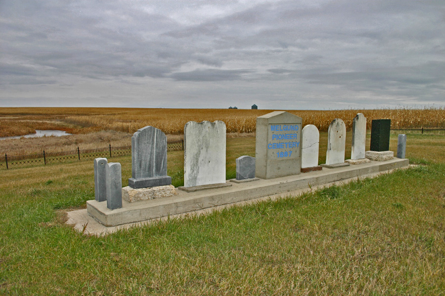
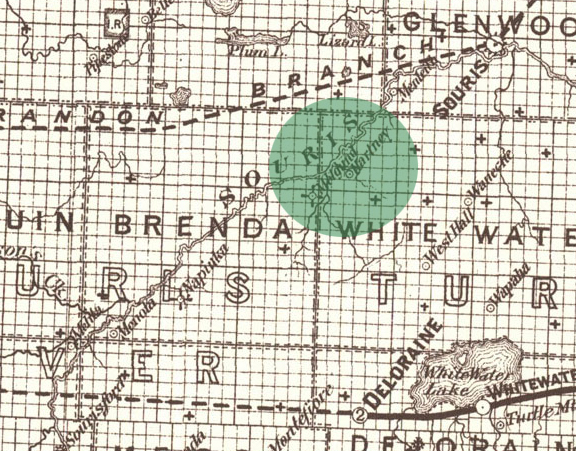
Both Melgund and Hartney appear on this map from 1887. There were no towns as yet – the map shows post office locations.
It would be nine years before the railway entered the district and the town of Hartney would be created.
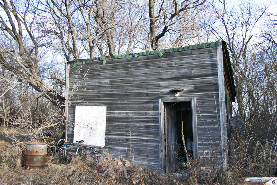
This small building served as the Melgund Post Office – and likely as a residence for a time as well.
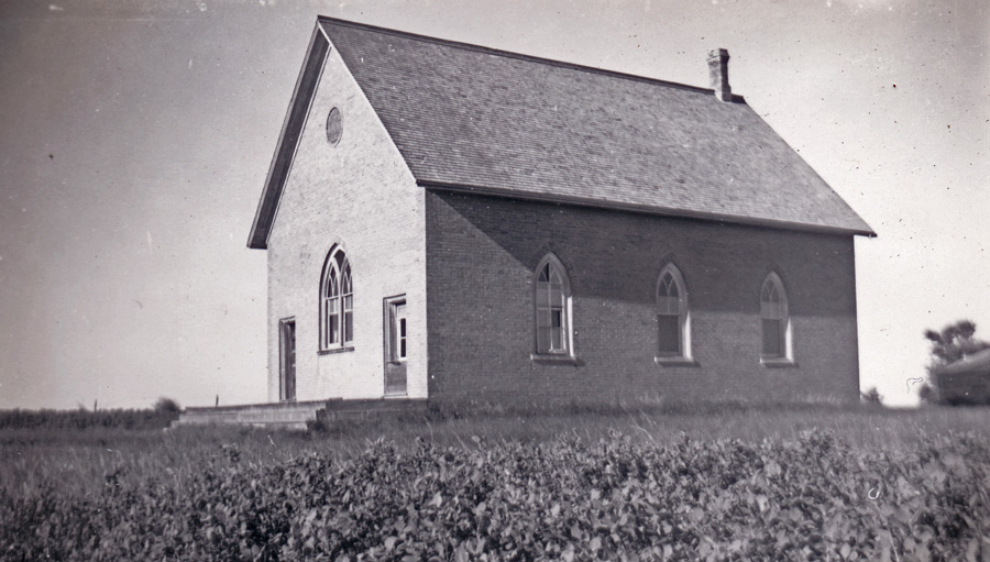
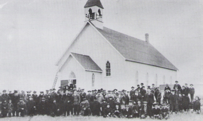
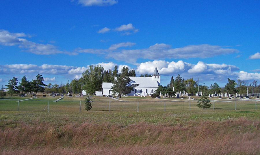
Melgund Methodist Church, taken in 1946
Vantage Points Articles
Melgund - Almost a Village Web / PDF
Vol. IV , Page 9
Page 39: Grande Clairiere
In 1885, a 30-year-old priest named Jean Gaire decided to leave France for Canada and help others move to this new country.
Grande Clariere
Vantage Points Articles
Grande Clairière Web / PDF
Vol.III, Page 31
Page 40: Sourisford
The Boundary Commission Trail
Modern use of the trail began in 1873. The British and United States Boundary Commissioners
followed a route along the 49th Parallel in their trek across the plains to mark the boundary between the U.S. and Canada.
Railways as of 1902.
Vantage Points Articles
Sourisford Linear Burial Mounds Web / PDF
Vol. 2, Page 40
Walter Thomas - Against All Odds
Web / PDF
Vol. IV, Page 42
Walter Thomas - Kitchen Table Surgery
Web / PDF
Vol. IV, Page 42
Page 41: Manchester to Melita
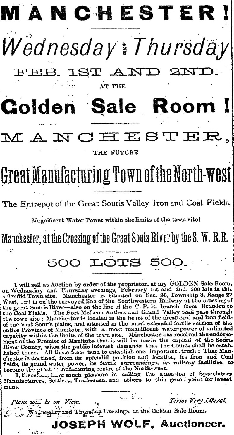 Melita is one of many Manitoba
towns that had its original location
abandoned
when a nearby site was chosen by a railway company. In this case, the town of Melita had only a short way to travel. 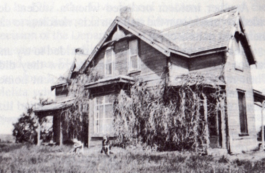 This house was the original school and church in Manchester. |
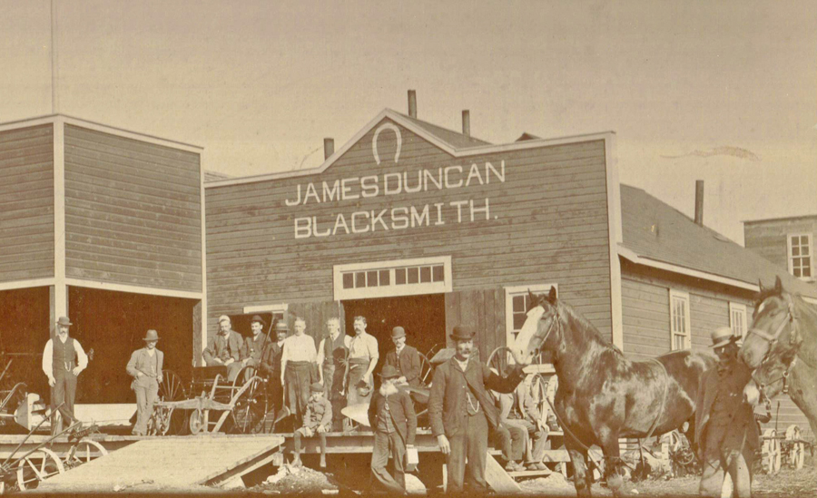
James Duncan moved his busines to to the "new" Melita location in 1890.
Vantage Points Articles
Manchester to Melita / Web / PDF
Vol. II, Page 37
Old Melita Trail / Web / PDF
Vol. I , Page 24
Page 42: Dobbyn City
 John Dobbyn – Melita Pioneer and Businessman The “Manitoba Boom” hits the Southwest Corner 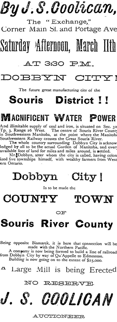 Winnipeg Daily Sun - March 9, 1 882 The railway did eventually come in
1890, but Dobbyn City was long
forgotten and the river was crossed about a mile further
downstream.
Mr. Dobbyn had long since focused on his farm, and became a leading
citizen of the new town of Melita.
|
Vantage Points Articles
Dreaming Up Dobbyn City Web / PDF
Vol. IV, Page 8
Page 43: Butterfield
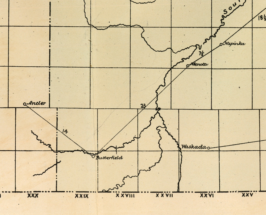
Butterfield, a Post Office and Stopping Place on the Boundary Commission Trail,
was one of the first “places” in the southwest corner to appear on any map.
The name Butterfield lives on as the name of the school built nearby.