
| Home |
Contents | Downloads | Resources |
Chapter 6: Communities
Page 33: Wakopa - The first “Stopping Place” for settlers heading west
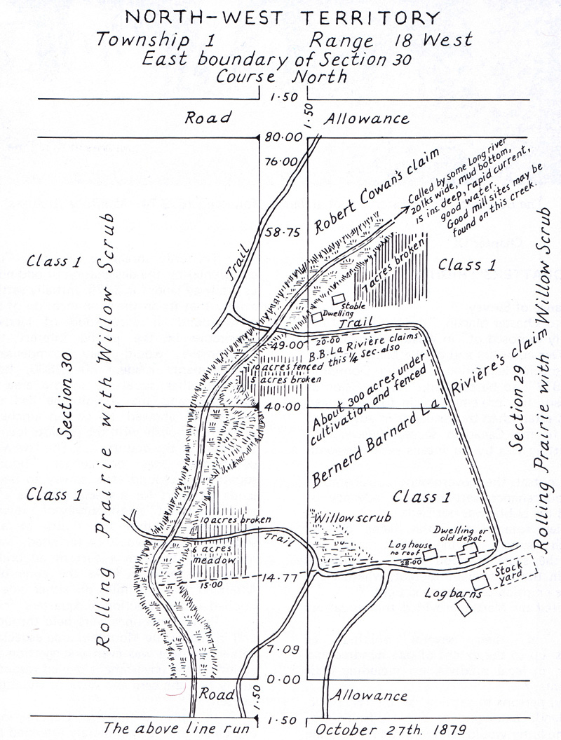
| Wakopa
was the first of the villages that were to pop up in the first few
years of European settlement – before the arrival of the railway. |
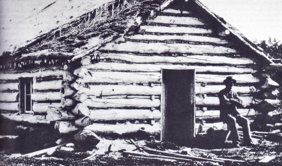
The LaRiviere House
|
Page 34: “Old” Desford.
| An
Englishman named Barneby did a tour of the North American in 1883.
He passed through Brandon and then went south. In the book he published
he mentioned one of little villages that came and went in those early
days. “On our route we passed a store named Desford, where we watered our horses; but the water was bad. A road comes in here from Brandon. The Turtle Mountains are still to the south.” That’s about all he had to say. |
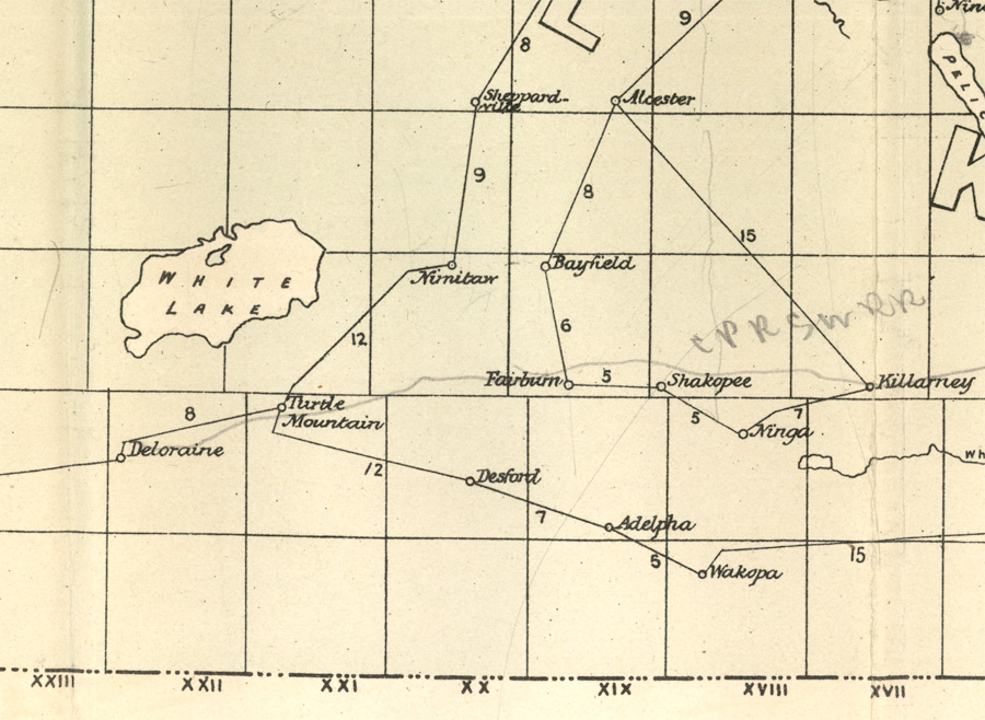
|
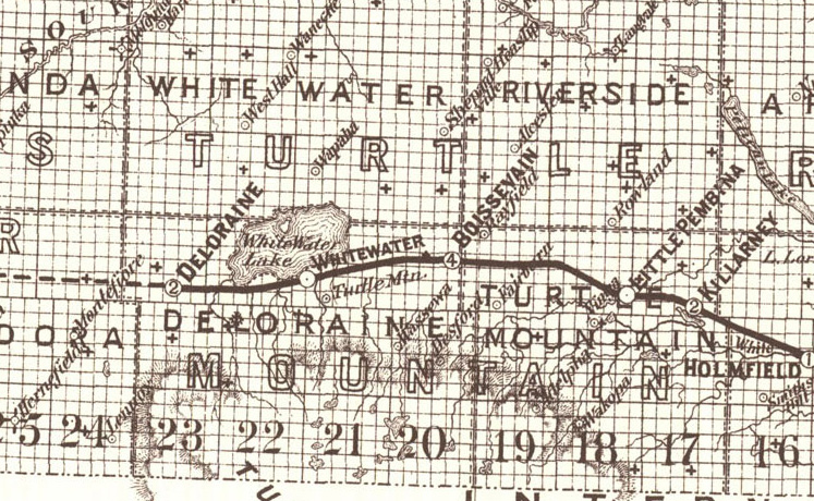
This map shows post offices in
1884.
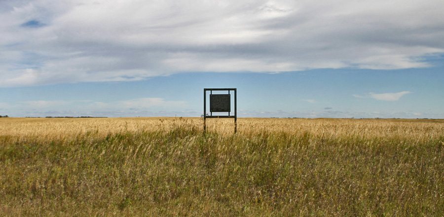
The Desford community began in the late 1870's along the Old Commission Trail about 12 kilometres south-southwest of Boissevain, and was, like Wakopa, one of the first trading centres in the area. People living where Boissevain would soon be located would do their shopping at Desford. Sunday Church service was held at a local home. Fox’s sawmill served the district in the early 1880’s and produced most of the lumber that was used for the first buildings in the region. Like nearby Wakopa, Desford seemed ready to become an important town if only the railway would pass through. That didn’t happen. The railway passed to the north and the town of Boissevain became the centre of the region. But the Desford story wasn’t over. In 1906 the Great Northern Railway was put down through the area and a small village, also called Desford, sprang to life. In 1908 the hamlet consisted of the water tower for the trains, the Railway Station, elevator, section house, bunkhouse, the Methodist Church, the blacksmith shop, a Community Hall, a General Store and a few houses. All traces of Desford, once located in this field, are gone. This sign, placed in 1970, is left to remind us |
Page 35: The Cheese King
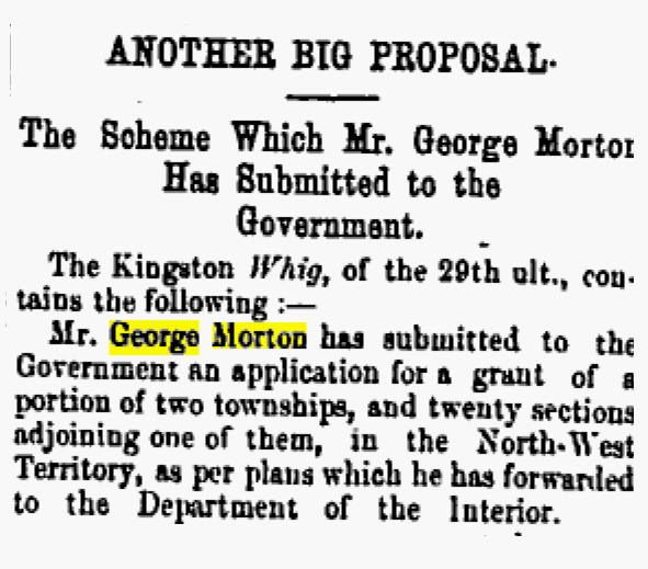 From the Winnipeg Times – May 5, 1881 In 1881 George Morton from Kingston Ontario applied to the government for a huge land grant on the north side of Whitewater Lake under the condition that he settle at least 75 families on the land. His plan was to create 108 dairy farms, 36 stock farms and cheddar cheese factory. By 1882 The Morton Dairy Farming and Colonization Company, had about fifty men employed on the farm and everything was said to be progressing as planned He acquired a sawmill recently established at Max Lake, and built a store at the new community of Waubeesh. Before long equipment and cattle were making their way westward. Mr. Morton had a very good plan – on paper. As so often happened throughout the west, the railway didn’t come through with its promise; it actually built south of the lake, and not until 1885. By that time the dairy operation was long gone, for the first harsh winter killed most of his stock, and it was downhill from there. The city newspapers which had devoted so many paragraph to the great plans, summed up the end result in one sentence 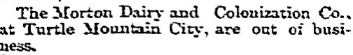 From the Winnipeg Daily Sun – May 31, 1883 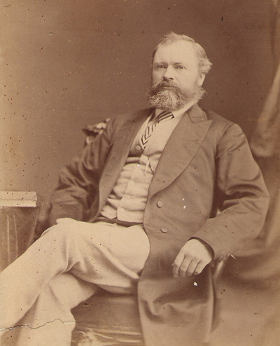 George Morton
Mr. Morton however proceeded with his other businesses (stores, sawmills, and elevators) and did very well. The Municipality of Morton is named after him. 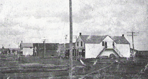 George Morton built this store in
Whitewater and owned several businesses in Boissevain.
|
Page 36: Turtle Mountain City & Waubeesh
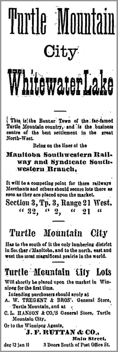
Winnipeg Times January 7, 1881
| Ads
like this one ran in Winnipeg newspapers regularly in 1881 and 1882. It was a time called the Manitoba Boom. Everyone wanted to get rich by buying land and hoping that the price would keep going up. Then they could sell at a big profit. These “cities” had several things in common. They all claimed they were going to be the main town of a region. They all claimed that the railways would pass nearby. They all simply lied about what was there. An early settler was quick to have one such city surveyed on his land. He called it “Turtle Mountain City” and claimed it was “The Banner town of the far-famed Turtle Mountain country” Turtle Mountain City actually consisted of a store, a post office and a Stopping Place. |
| By
the time the railway arrived in 1885, Turtle Mountain as it was then
called was just a post office. The railway passed to the north and the
new town of Whitewater was created. Waubeesh Nearby an actual village called Waubeesh had been started with stores, a blacksmith shop and even a church. But even with those services, it couldn’t survive when the railway passed it by. George Morton had a store there, and as soon as the railway came to Boissevain he moved it to the new town. |
Page 37: Old Deloraine
| In
1880 the Dominion government established a Land Titles
Office
south of Turtle Mountain along the Commission Trail. It was a
considerable convenience to settlers and a sure sign that many settlers
were expected. George Newcombe came to establish the office, bringing
with him his family, a governess, and the first piano to find its way
into the area. Before long, in February of 1881, he was father to the
first white baby (Louise) to be born there. Today we call the location Newcombe’s Hollow. |
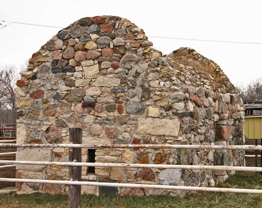
| All
that remains of “Old Deloraine” is this stone bank vault. The rest
of the village’s buildings were quickly moved to the new rail line a
few kilometres away. The location of the Land Titles Office, led, almost overnight, to the creation of a village nearby called Deloraine and before long it had “ two agricultural implement dealers, one general store, a grist mill, two blacksmiths, two ministers, agents of various kinds, a law office and a school.” When the settlers chose to build their village near Turtle Head Creek they had been assured by the Canadian Pacific Railway that they could expect a railway soon. But the CPR changed its plans and built the line a bit to the north. The arrival of the first mixed train into what was called “Track End” on November 8, 1886, meant the end of the original Deloraine. Merchants, implement dealers, blacksmiths and millers all moved to take lots on the new townsite. But they did decide to keep the same name. 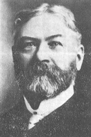 James Cavers was the first Postmaster in both “Old” and “New” Deloraine. He named the village after his old home in Scotland. |
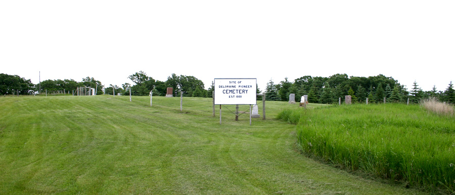
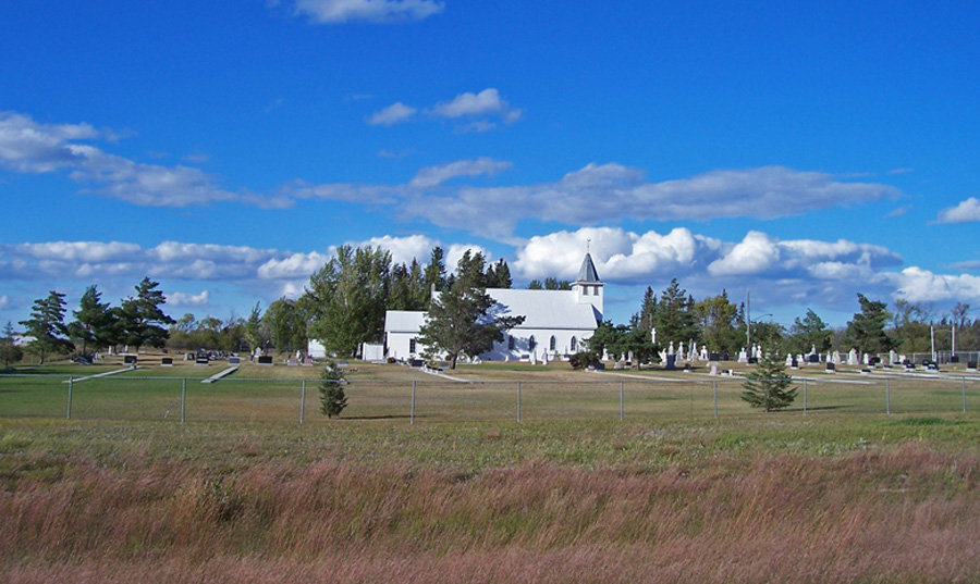
The Deloraine Pioneer Cemetery – still in use.
Page 38: Melgund & Hartney
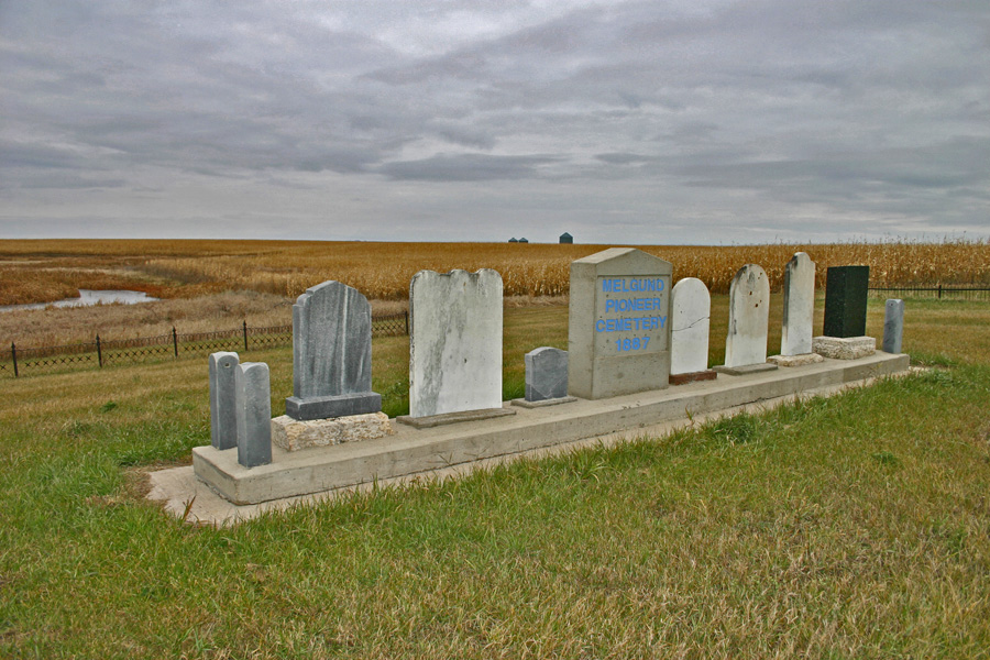
| Southwest
of Hartney on Melgund Road, there is a small cemetery at a
crossroads. Established in 1887, it was the first graveyard in the
region. Across the road, a cairn helps to mark the spot that was home
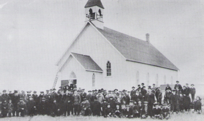
for many people over many years. Early in 1881 Samuel Long and John Fee came from Ontario to this area. The sod shack they erected that first season, soon known as “The Shanty” or “The Orphan’s Home”, was a stopping place and temporary home to many settlers over the next two years. 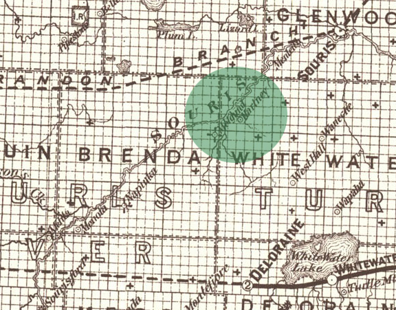 Both Melgund and Hartney appear on this map from 1887. There were no towns as yet – the map shows post office locations. It would be nine years before the railway entered the district and the town of Hartney would be created. In the meantime it was Melgund that seemed to be where things were happening. The name Melgund first appears as a Post Office opened in 1882 in the home of W.J. Higgins. Rose School opened in, 1884, one of the first in the area. It was also used as a church before the Melgund Methodist Church was built across the road. 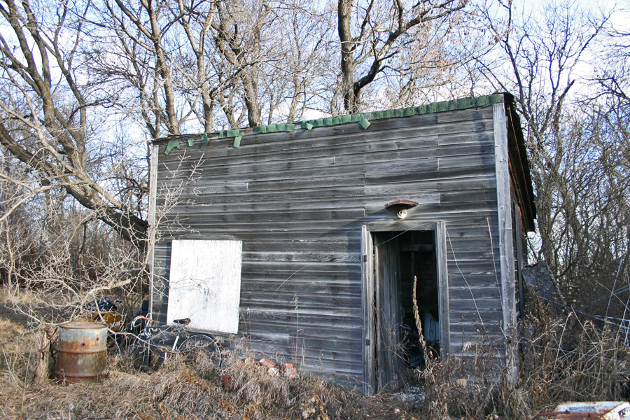 This small building served as the Melgund Post Office – and likely as a residence for a time as well. 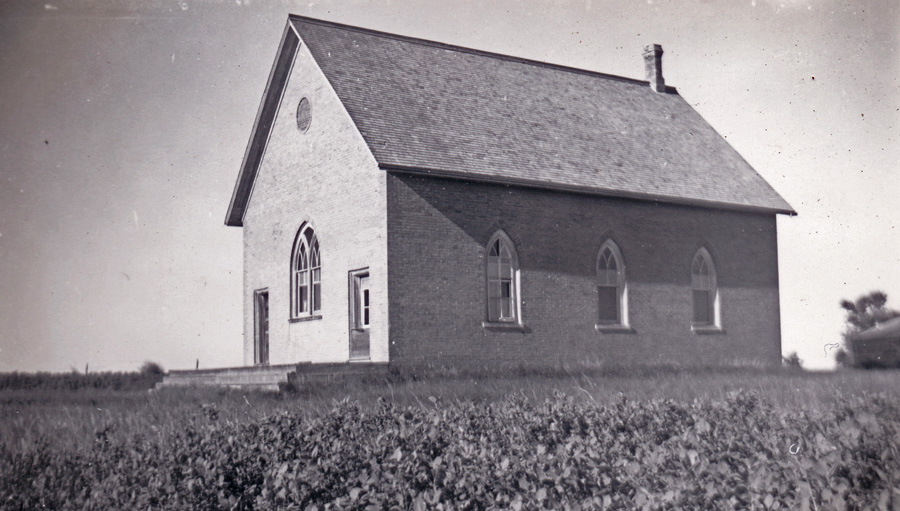 Melgund Methodist Church, taken in 1946 When the first settlers arrived they had to build some shelter, break some sod, and plant some grain and vegetables. Before long they would get together and build a school. They might build a church, and then, perhaps, a general store or a blacksmith shop might open for business. But most such settlements never did become towns as we know them, with rows of houses and a main street for stores and shops. |
Page 39: Grande Clairiere
In 1885, a 30-year-old priest named Jean Gaire decided to leave France for Canada and help others move to this new country. By 1888, homesteaders from Eastern Canada, Great Britain and Europe had settled much of the land along the Souris River. Father Gaire, arrived at Oak Lake Parish on July 10, 1888 and set off in a southwesterly direction, in search of a suitable location to start a new community. They found a large clearing that pleased the young priest. A few Metis families lived nearby, so he decided to settle and called the place "Grande Clairiere." Father Gaire applied for a homestead. He described his first church service in his memoirs: "At 9 o'clock my three Metis families were there - 6 adults and 10 children. I have neither choir nor children to serve Mass; I say a low Mass, all the time admiring the simple, open piety of these brave people." Soon his new community had a few more Metis families and some settlers from Loire in France. The population tripled in three months! By April 1889 settlers began to arrive. There were now 43 homes and close to 150 people!! During the winter of 1889-1890, Father Gaire returned to France for a month as "Immigration Agent" for the Canadian Government. On March 23, 1890, forty French and Belgian immigrants came to Grande Clairiere. By 1893, the community had a post office, a church and rectory; and had started building a school. Father Gaire's dream was to have more than an ordinary school; he wanted a boarding school where children from distant missions, that had no educational facilities, could be accommodated. In the spring of 1898, construction began on the first convent. The sisters arrived in Grande Clairiere on August 11, and the school opened on August 18 with 20 pupils registered. In 1903, his dreams in Grande Clairiere fulfilled, Father Gaire requested a transfer to a new mission in Wauchope, Saskatchewan. |
Grande Clariere
Page 40: Sourisford
| It
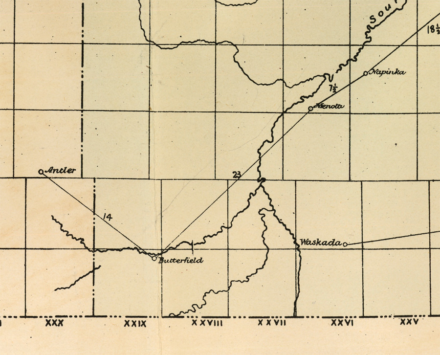
all started with a river crossing. About ten kilometers north of where the Souris River crosses the US border, a gravel ridge in the river bed forms a natural crossing that has been used for centuries. Bison herds in their yearly migrations, Aboriginal Peoples on their hunting trips, fur traders and Metis pemmican brigades, each used the site. |
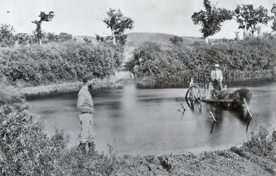
The Boundary Commission Trail Modern use of the trail began in 1873. The British and United States Boundary Commissioners followed a route along the 49th Parallel in their trek across the plains to mark the boundary between the U.S. and Canada. Sourisford The crossing at Sourisford was the obvious place for a village. Soon T.B. Gerry set up a blacksmith shop – a necessity for a farming community. The Gould – Elliot Stopping House, was also a store and post office. Another store was operated briefly out of a tent by Warren & Snider. R. N. Graham, already established in Melita, established a branch store at Sourisford. If the railway line that connected Brandon with southeastern Saskatchewan in 1890 had crossed the Souris River here instead of Melita, a major town would have grown here and Melita would have faded. But Sourisford became a rural community with just a post office and store rather than a full village. In 1901 when another CPR branch stretched westward from Waskada and established Coulter a few kilometres away, Sourisford became one of dozens of Westman communities that had served its purpose and was no longer needed as a commercial centre. 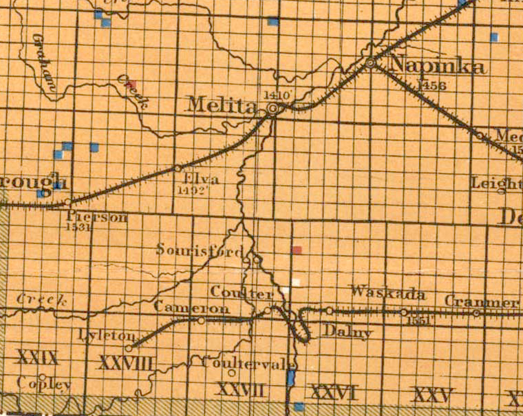 |
Page 41: Manchester to Melita
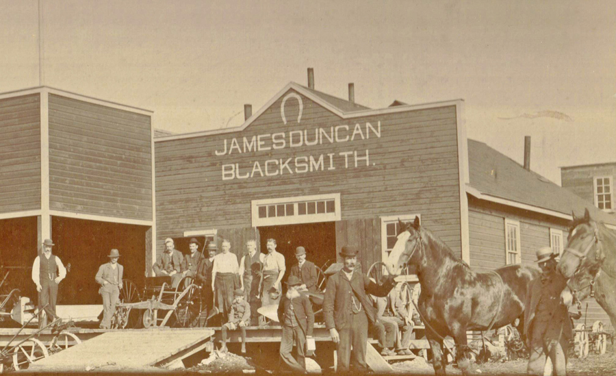
 Melita is one of many Manitoba towns that had its original location abandoned when a nearby site was chosen by a railway company. In this case, the town of Melita had only a short way to travel. By 1882 three identifiable communities developed within a few miles of the current site of Melita. Sourisford at the old Boundary Commission Crossing, Menota, a store & post office to the east of where Melita would later be, and Manchester just west of the current town. In 1881, homesteader Dr. Sinclair had a quarter section of his land on the west side of the Souris River surveyed as a town site. Lots were sold to buyers as far away as Winnipeg. In 1883 R. N. Graham started a store, which was quickly followed by another one, a blacksmith shop, an implement agency and a public school. 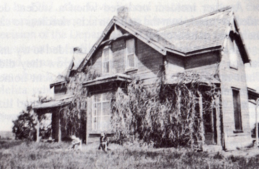 This house was the original school and church in Manchester. The problem was the name they had chosen, “Manchester”. In 1884 when the townsfolk put together a petition to open a post office, they were informed that Manchester had already been adopted by a settlement in Ontario. They got together and chose Melita. And so the town was born, and as usual the business owners and residents were content to move a kilometre or so east to be alongside the new rail line when it arrived. Melita pioneer James Duncan started his first Blacksmith Shop in Manchester. He quickly moved to the new location when the railway arrived nearby. |
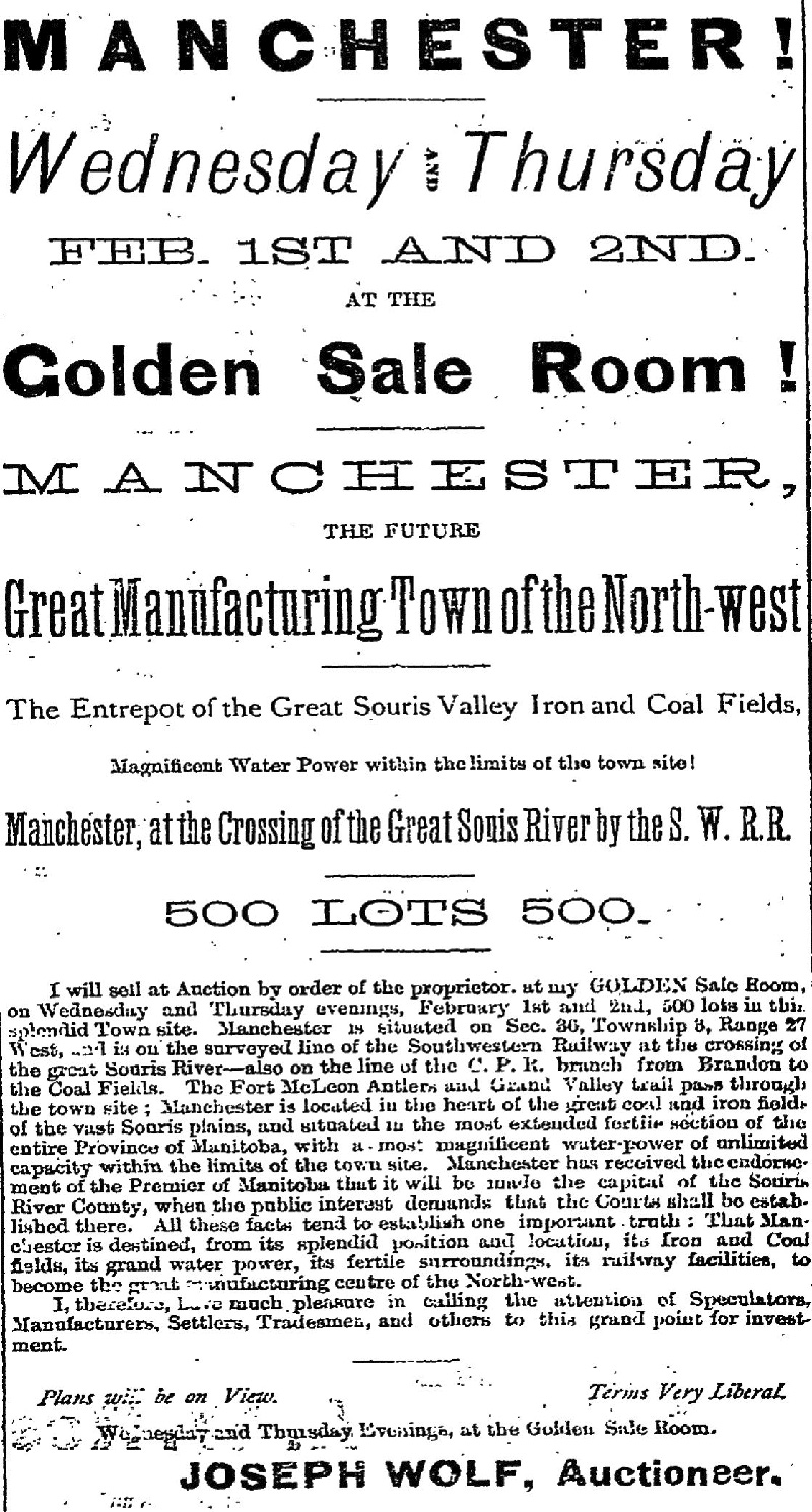
Page 42: Dobbyn City
The
“Manitoba Boom” hits the Southwest Corner John Dobbyn – Melita Pioneer and Businessman Pioneer John Dobbyn had selected a homestead along the Souris River near where Melita would later be located. He, and many of the other settlers expected that a railway line would pass nearby, and that his land would be a good spot for a town. If that happened the land would be valuable. Across the province there were many people speculating in land. They hoped to buy land that was now empty, but would later be a town, and be worth much more. They hoped to get rich. Knowing this, Mr. Dobbyn had “Dobbyn City” surveyed and marketed. It was a typical example of the paper city. It was just believable enough to be sold and also full of wishful thinking and outright lies. Apparently the ads worked… for a while. In March of 1882, The Winnipeg Daily Sun reported the sale of 80 lots at an average of $30 each. How much, if any, of that money made its way into Mr. Dobbyn’s hands, no on knows. Have a look at the ad from the Winnipeg Daily Sun, March 9, 1882. People in Winnipeg or back east had no way of knowing that no railway would be built for another eight years, or that no real businesses or houses yet existed in Dobbyn City. It didn’t matter - they just hoped it would happen and their $30 lots would be worth ten times that much. 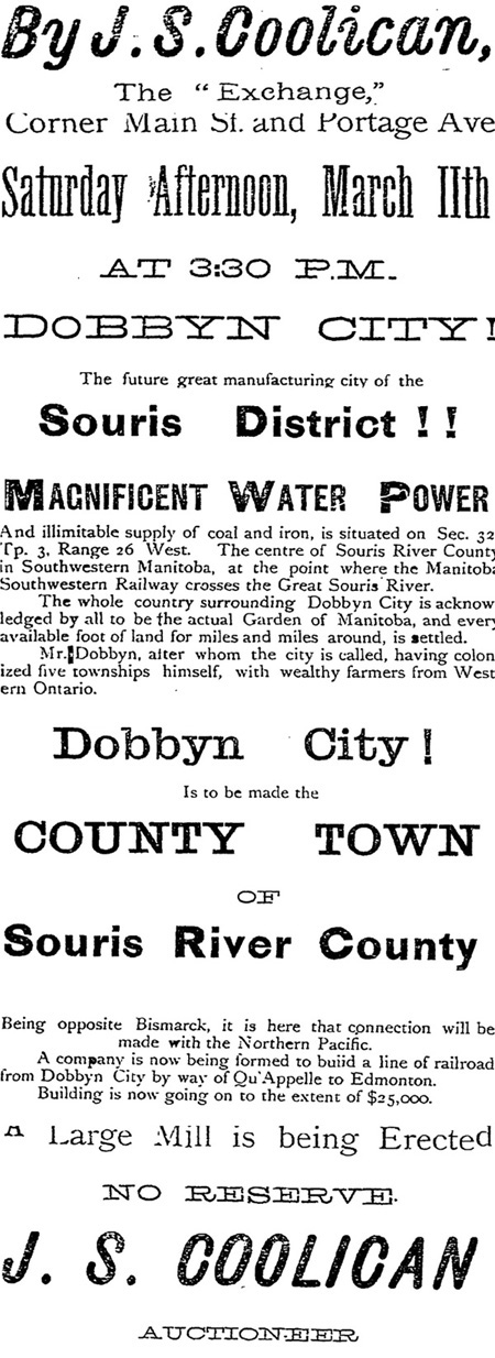 Winnipeg Daily Sun - March 9, 1 882 The railway did eventually come in 1890, but Dobbyn City was long forgotten and the river was crossed about a mile further downstream. Mr. Dobbyn had long since focused on his farm, and became a leading citizen of the new town of Melita. |
Page 43: Butterfield
Butterfield, a Post Office and Stopping Place on the Boundary Commission Trail, was one of the first “places” in the southwest corner to appear on any map. Until recently, in a pasture a few kilometres southwest of Pierson, one could still see the remains of an old sod building by an old rutted trail. Before the railway arrived in the southwestern tip of Manitoba, before Pierson was established, the mail came to Butterfield. The first post office was in a sod hut built by Dr. Joseph Dann, on his farm along the Boundary Commission Trail, and operated by his brother Henry’s family. As often happened the Post Office was a likely spot for a Stopping Place and being on the well-used trail made the location even more convenient. Before the post office was opened in 1884, one of the settlers near Sourisford used to go to Brandon with an ox team about twice a month for everyone's mail and supplies. Butterfield received its mail by stage coach. The exact location of the buildings is hard to find now, and the trails have been worn away by time. 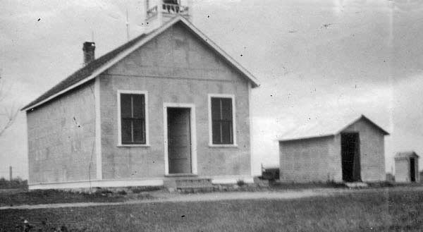 The name Butterfield lives on as the name of the school built nearby. Related Resources
|