The first settlers had chosen a
site roughly two miles east of the
present site of Tilston and established a community they called
Eagleton. When the C.P.R. brought the railway through in 1907, they
established the town at the current location and the name Tilston was
chosen. Mr. Harold Bateman had submitted the name Tilston as it was his
home town in England.
Tilston was the end of the C.P.R. line, with a Y turn around which ran
across what is now the sports ground. In 1911, the extension of the
line to Alida was commenced. With the coming of the C.P.R. and the
starting of the town, more settlers arrived and among the early
buildings was a boarding house, a hardware, a blacksmith shop, a small
school building, and a box car for a station.
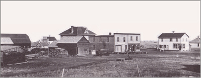
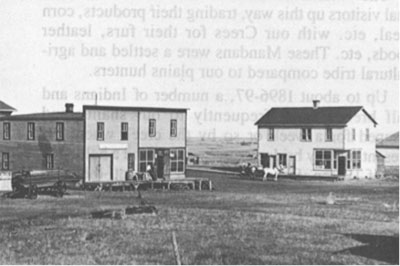
Railway Avenue, Tilston
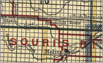
 Area
Tilston Area: Code 556
Area
Tilston Area: Code 556
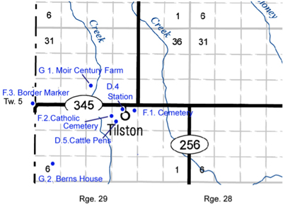
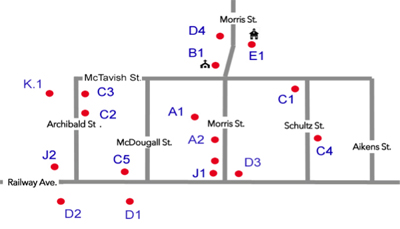
Village Map
A.1 – R.M. of Albert
Building
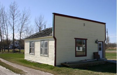
A.2 – Former Municipal Office
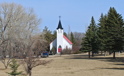
B.1 – Tilston United Church
C.1 – McLeanHouse
C.2 – Jones House
C.3 – Mb. Pool House |
C.4 – Berns House
C.5 – Sterling House
D.1 – Pool Elevator
D.2 – Lake of the Woods Elevator
D.3 – Royal Bank Building
D.4. - Former CPR Station |
E.1 – Tilston School
F.1 – Tilston Cemetery
F.2 – Tilston Catholic Cemetery
J.1 – Tilston Hall
J.2 – Tilston Rink
K.1 – Tilston Prairie Orchard |
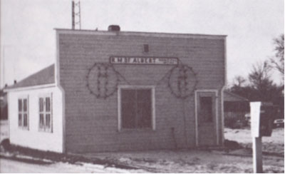
R.M. of Albert Building
Morris St.
556.A.1
1951
Former Municipal Office
Morris St.
556.A.2
ca. 1906
As of 2016 this building has been re-purposed as a guest house –
popular in the hunting season.
Municipal Office - 1984
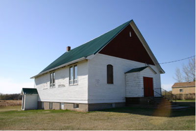
556.B.1 - Tilston United Church
31 Morris St.
556.B.1.
1923
In the first years Presbyterian or a Methodist Minister served it.
Consolidation in 1925.
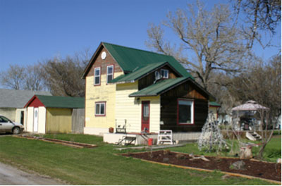
McLean House
Schultz St.
556.C.1
ca. 1910
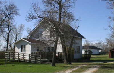
Jones House
Archibald Street
556.C.2.
Ca. 1910
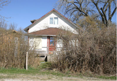
Former Mb. Pool House
Railway Ave.
556.C.3.
ca. 1910
Berns House
Schultz St.
556.C.4 .
Ca. 1910
Sterling House
Railway Ave.
556.C.5 .
ca. 1915
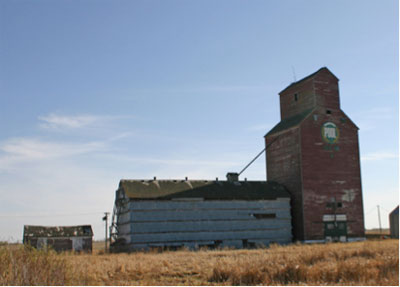
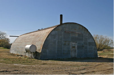
Pool Elevator
Railway Ave.
556.D.1.
1928
Manitoba Cooperative Elevator Association, also known as the Manitoba
Pool
Annex – ca. 1950
"TILSTON / Co-Operative Elevator Association / POOL NO. 61 / Service At
Cost"
The gray, metal-sided frame annex probably was built in the 1940s or
50s, as many of these were erected for temporary storage during the
post-war years.
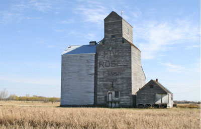
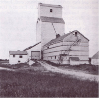
Lake of the Woods Elevator
Railway Ave.
556.D.2.
1949
Lake of the Woods Milling Co. built the 25,000-bushel east elevator in
1949, after fire destroyed its older Tilston facility. “Five Roses
Flour”, the company’s signature brand, was painted on the side.
"Five Roses Flour” Logo
Sold to Manitoba Pool in 1959, became Pool Elevator B
30000 bushel annex.
The CP Alida subdivision used to serve this town but it was abandoned
in 1978.
Basic machinery that still functions after 53 years in operation.
There is an old manual manlift and a wood leg with woven-to-width
cotton belting and Salem steel buckets. When the original rope drive to
the leg broke, Everett moved a new, 1,100-lb. electric motor to the
headhouse on the manlift. A rope from the lift to his grain truck
created a counterweight.
Former Royal Bank
Railway Ave.
556.D.3.
1919
Built as a 2-storey building – Royal Bank, closed in 1935.
Once Lamonby’s Store
Imperial Oil Dealers: Bourque, Tom – 1939 - 1950
Burrill, Cliff 1950 - 1973
Also used as a Residence, and as of 2016, storage for the Municipality
Frame / Metal siding
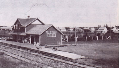
Tilston CPR Station
Tilston
566. D.4
1910
GPS: N49.396115 W101.313913
M. Desender purchased the building from the
CPR. The top half of the 2-story station sits vacant and in disrepair.
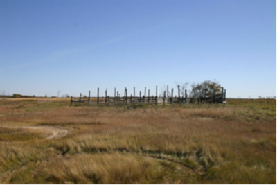
Tilston Cattle Coop Loading Pens
Tilston
566.D.5
ca. 1970
GPS: N49.392356 W 101.323766
Built by Tilston Cattle Coop - Manson Moir &
others.
A small group of cattle producers formed a coop for the purpose of more
efficiently marketing their cattle. They built this modest loading
platform and pen just west of the elevators in Tilston. Trucks were
contracted to take the cattle to market.
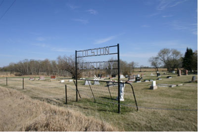
Tilston Cemetery
NE 15-5-29
566.F.1
1908
GPS: N49.39941, W101.30360
Land purchased from the Kildahl estate.
First petition to purchase land for the cemetery was in 1908.
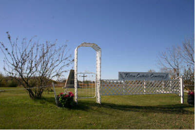
Tilston Catholic Cemetery
E 17-5-29
566.F.2
1927
GPS: N49.39278, W101.32504
Has a monument commemorating the Tilston St. Anthony Catholic Church,
established in 1927.
Closed 1993
Church moved to a site near Kemnay - used as a music studio.
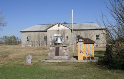
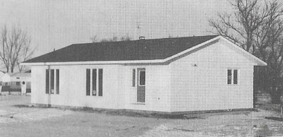
Tilston School
Morris St.
556.E.1.
1947
Monument erected 1990
Closed 1987
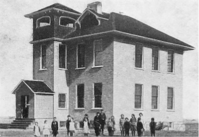
First School, built as Eagleton
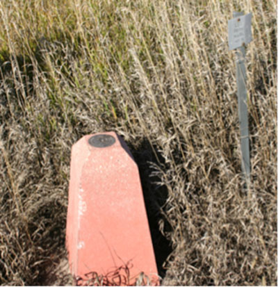
Border Marker
SE 19-5-29
581.F.3
1969
GPS: N49.399621 W392133
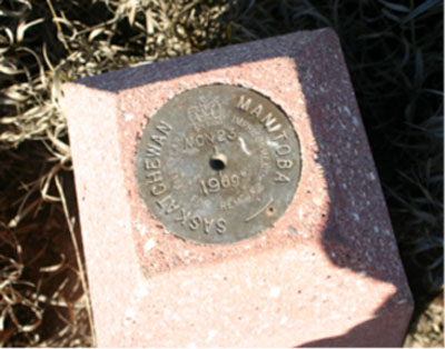
Cement cairn marks the border between Saskatchewan and Manitoba
directly east of Tilston
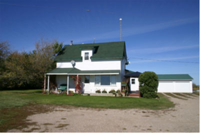
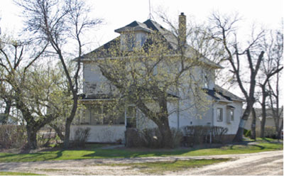
Moir Century Farm
NW 21-5-29
566.G.1.
1913
GPS: N49.407579 W101.343797
The home of Manson & Barbara Moir was built by Manson,
William & Eliza Jane Manson.
Later the residence of George Moir and Wilda (Manson).
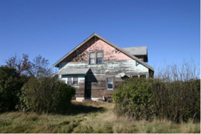
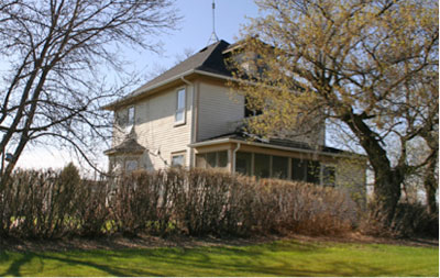
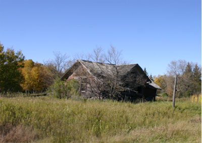
Xavier Berns Farmhouse
W 6-5-29
666. G.2
1928
GPS: N49. 367894 W 101.383568
The east half of 6-5-29 was purchased and, in the spring of 1928,
Xavier and Hannah moved to the west half of 6-5-29. In the fall of
1928, a two story home was built.
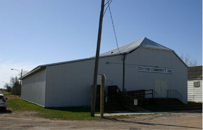
Tilston Community Centre
Morris St.
556.J.1.
1944
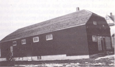
The Hall in 1944
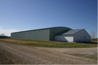
Rink
RR. Ave.
556.J.2 .
1927
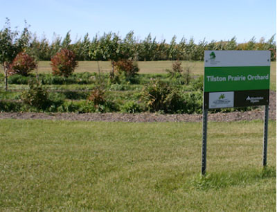
Tilston Prairie Orchard
Tilston
302. K.1
2014
GPS: N49.487803 W101.944948
Located on the Sports Grounds.
A Forest Enhancement Program sponsored by the West Souris River
Conservation District and Manitoba Hydro.
|