|
The Impact of
the GTP
On
Rivers and the R.M. of Daly
A component of…
The
Grand
Trunk Pacific Railway in Rivers, Manitoba
A Project
of The Rivers Train Station Restoration Committee
2014
The Grand Trunk Pacific in Rivers and Daly
Setting the Stage
The settlement of the Rivers/Daly area began in the late 1870’s. The
deep wooded valley of the Little Saskatchewan River was attractive in
that it provided ample water as well logs for building and fuel. Until
1879, settlement focused on the new town of Rapid City and the
settlement of Odanah (Minnedosa). By 1880, a trickle of settlers
approached the district taking the Assiniboine river steamers up the
Assiniboine to Grand Valley or Hall’s Landing, near where Hall’s Bridge
stands today – north of Oak Lake. The arrival of the railway to Brandon
in late 1881, brought increased settlement.
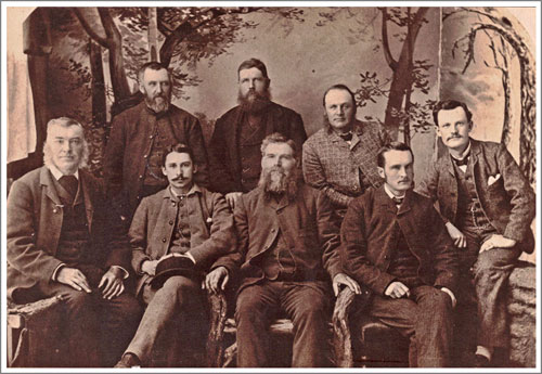
County Council of County of
Brandon (1882)
BACK ROW –
Reeve Pettit of Daly Municipality; Reeve Clegg of Elton
Municipality; Reeve Whitehead of Cornwallis Municipality.
FRONT ROW-
Reeve Steel of Glenwood Municipality; W.A. Macdonald, County
Solicitor (Justice Supreme Court of British Columbia); Reeve Hannah of
Whitehead Municipality; J. Weatherall, County Clerk; J.H. Brownlee,
County Engineer.
The Rivers area, in its early years, had developed in much the same way
as other rural regions of Manitoba. For the first twenty years after
farming operations commenced the scattered rural nature of settlement
in the area was characterized by various small rural centres. Schools
and post offices were the first “community” buildings to appear, while
a few churches followed. Soon communities such as Tarbolton, Roseville,
and Ancrum evolved around the local church and regional school. These
were well known communities without becoming villages. Other
communities were identified only by their schools, with Harrow and
Hunter being early examples. The centres of Wheatland and
Bradwardine were simply post offices in their early days.
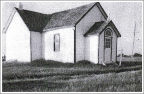
Roseville
Mission Hall built in 1884 and shared by four congregations.
Transportation was by foot, ox cart, and horse-drawn wagons. The
problems of delivering products to market was a major obstacle to
economic development.
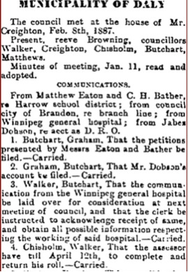 Feb.
24, 1887 - Brandon Sun.
Feb.
24, 1887 - Brandon Sun.
Before
Town Halls, indeed before there were towns, local governments
met in houses and got the jobs done.
In 1891, the R.M. of Daly occupied a middle territory between the
original C.P.R. main line (1882) to the south and the newer northern
line (1885) through Minnedosa and Birtle. Although this presented some
hardship, settlement was progressing.
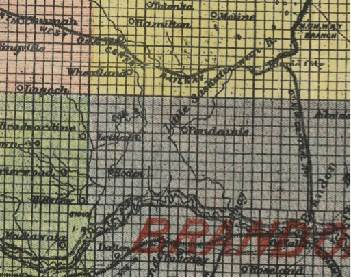
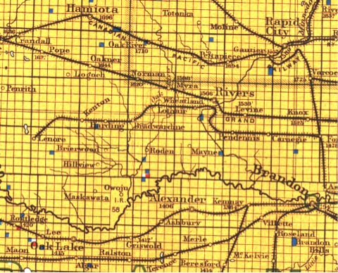
Note the communities of Lothair,
Pendennis and Roden, surrounding the
region where Rivers was yet to be.
Post Offices, schools and churches and some general stores were
established, but no towns were surveyed or built. If names like Roden,
Lothair, or Pendennis appeared on early maps it was likely the location
of a Post Office that merited inclusion. Nearby centres, first Rapid
City, then Brandon served as both markets for produce and outlets for
supplies. For over twenty years, surely a record in southwestern
Manitoba, no railway crossed the district. Across the province in the
early 1880’s speculative or “paper” town were promoted based on
supposed assurances that railways would soon appear. In Daly, perhaps
such effort would have been overshadowed by the surprising growth of
Brandon, right on its southern border. Perhaps having that excellent
source of both supplies and markets, available by the second real
harvest, allowed for a certain level of contentment. Progressive
municipal government as well as active local communities and school
district boards, provided the infrastructure and service that settlers
needed.
The growth of towns as commercial centres usually happened, with
varying degrees of quickness, after the arrival of rail lines.
In 1902, a much-anticipated C.P.R.
branch line connected the district
to Brandon and the main C.P.R. line. The communities of Carnegie,
Pendennis, Wheatland and Bradwardine were created.
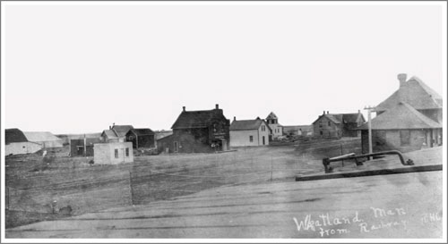
Wheatland
was the R.M. of Daly’s commercial centre before the arrival
of the Grand Trunk Pacific.
The branch was no doubt much appreciated. The accompanying
establishment of both retail services and elevators made life easier
for everyone. It was progress, but perhaps not a big readjustment in
social cultural or economic life. Welcome as this connection was it was
the second railway endeavour that would have the largest impact on the
economic and social development of the area.
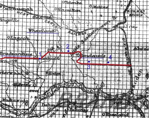
By 1902, the Great Northwest Central Railway had built a line from
Forrest to Lenore. The new villages of Bradwardine (1), Wheatland
(2) , Pendennis (3) and Carnegie (4) were established. All of
these names except Carnegie were already on the map as Post Offices,
but in each case the location was changed as the Post Office moved to
the new railway settlement.
The Grand Trunk Pacific in Rivers
That development was given a substantially new direction in 1907, when
the Grand Trunk Pacific selected the site of Rivers as a stop on their
new trans-continental line. The creation of a second line almost
paralleling the first brought further important and lasting changes.
Whereas the first line was a C.P.R branch connecting to Brandon, the
second line was a new transcontinental railway built by the Grand Trunk
Pacific and it established Rivers as the important centre of the region.
The decision of the Grand Trunk Pacific to build a line across the
prairies, a decision made far away and likely with no thought or
concern about local impact, would bring about substantive and lasting
change to the R.M. of Daly. The line proceeded parallel to the C.P.R.
main line in an almost straight line from Portage La Prairie westward,
so close to the competition that no new towns were required until it
passed McGregor where the CP line angles slightly southwards. It then
sprouted town and villages in regular steps beginning with Firdale and
following the alphabet through to Levine. Because it was decades after
the first settlement rush, there was no real need for any these
villages to progress commercially beyond an elevator or two with a few
other retail outlets. But at the crossing of the Little Saskatchewan
there was a need for a significant service centre with roundhouse,
yards, and other services. A town was required and almost overnight
Rivers, named after a director of the Grand Trunk Railway, went from
being farmland to a carefully planed and substantial town.
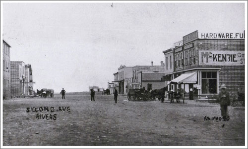
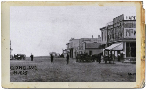
Second
Avenue during the building boom that followed the arrival of the
new rail line. Photo courtesy the Archives of Manitoba
The implications for the entire municipality were far-reaching. With
the establishment of rail service and retail establishments, trips to
Rivers replaced trips to Brandon. The nearby settlement of Wheatland on
the rival C.P.R. branch line was eclipsed. The railway jobs attracted
people from a wide variety of places, broadening the social and
cultural makeup of the region.
In 1907, the Grand Trunk Pacific entered the municipality from the east
with stations at Levine and Myra, and most importantly, a divisional
point and major town at Rivers.
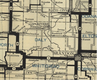
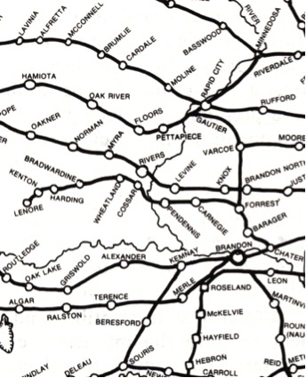
The above
map, from 1915, shows the two lines crossed the municipality
at the height of railway development.
The Grand Trunk Pacific was a widely anticipated and vigorously debated
attempt to create a new trans-continental rail line. It was
optimistically pursued and for a relatively short time, a very
influential factor in the development of Western Canada. This vital
connection to the rest of the country forever changed life in Rivers
and area.
The arrival of rail lines allowed for much easier shipment of grain and
by 1911, these elevators were established and thriving. Aside from
grain delivery, the railway was a commercial lifeline in countless
ways, while the social implications of this convenient link to the
entire nation were far reaching.
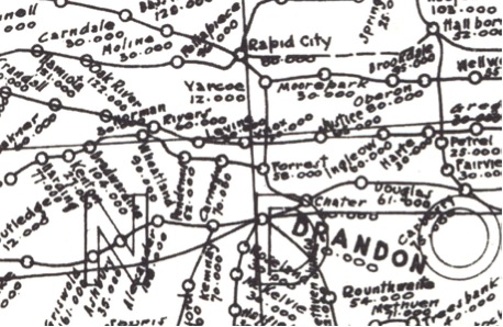
This 1917
maps show the available elevators. In the first decade of the
twentieth century great strides were made in infrastructure for grain
marketing.
The C.N. Years
On July 12, 1920 the GTPR was placed under the management of Canadian
National Railways (CNR) and in 1923, was completely absorbed into the
CNR. This had little effect on day-to-day operations in Rivers as the
C.N. remained committed to maintaining service and upgrading both lines
and facilities as needed. The changes that were to come were nationwide
changes related to the increased use of the automobile for personal
travel and trucks for freighting.
This road map from 1930 shows the network of roads. Increased use of
cars led to better roads, which led to increased use of cars, and the
cycle continues until this day. Before long railway use was declining.
 Rail
line expansion reached its peak in western Manitoba by about 1915.
This 1935 map shows the extent of rail development.
Rail
line expansion reached its peak in western Manitoba by about 1915.
This 1935 map shows the extent of rail development.
Rail line development reached its peak in the time of WW1 and the first
rail abandonment began in 1936. Grain shipment kept elevators and thus
rail lines open for a time but with larger truck and even better roads
farmers were able to transport grain longer distances. Another factor
was the better maintenance of roads – particularly the practice of
plowing in the winter.
The result was that, one by one, prairie towns lost, first their
stations and passenger services, then freight service, and finally
their elevators. This was all part of a more general re-structuring
that left the smaller communities less necessary and less viable while
concentrating services in larger communities like Rivers. River’s
maintained its economic position largely due to the presence of the
divisional point established there by the Grand Trunk Pacific and
continued by the Canadian National.
The railway provided jobs, both directly and indirectly. It provided a
convenient and reliable contact with the rest of the province and the
country. It’s presence shaped the character of the community in ways
that went far beyond mere economics.
If a Prime Minister, a Royal Couple, or even a Championship Grey Cup
Team were crossing Canada they might well stop at Rivers. If one needed
to visit Vancouver or Montreal the station was right there. If your
business needed to make or receive regular shipments from Winnipeg or
Edmonton, the service made it easy.
The people who came to work on the railway were from all over the world
and brought with them customs and skills that fostered a diversity and
acceptance.
The Future
The Golden Age of railway travel may seem to be at an end but with the
recent interest in railway as an environmentally sustainable
transportation option may bring back the Rivers Station as a
transportation hub for a new millennium.
The Rivers Train Station Restoration Committee members are dedicated to
the Restoration, Renovation & Rejuvenation of the Rivers Train
Station to a viable property for heritage preservation and economic
development. To ensure the Community & Area have an opportunity to
Connect with the Past while creating a Vision for the Future.
The station is a federally designated heritage site.
The method of restoration will be carried out following the most
environmentally efficient criteria making this Canada's first 'green'
heritage train station!
Funding for restoration is being made possible through grants,
corporate and individual support, as well as fundraising.
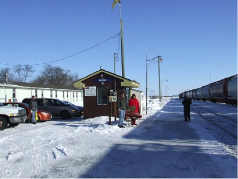
VIA Rail Canada has sited Rivers as the only boarding station west of
Portage la Prairie into eastern Saskatchewan, and between the north and
south Manitoba borders.
So the story is not over. It began with the decision by the Grand Trunk
Pacific to cross the Little Saskatchewan River here and top create a
divisional point. It continued through decades of progress, setbacks,
and more progress.
It continues.
|