| Page 2:
The Evolution of a River Valley
It's story begins about 6000 years years
ago as the land in the southern prairies was coming out of the most
recent (not perhaps the last) ice age. As the glacier receded, melting
on it's way, the waters gathered , waited, and then followed the ice.
They gouged deep trenches into the gravel and shale as they fell
northwards. In a particular stretch of southern Manitoba, one such
stream led into the province near the southwest corner and proceeded
northeast towards present day Souris. It then took a right angle turn
and charged southeast, then east, before emptying into what was to
become the Red River. Their combined waters then flowed northwards into
the retreating sea.
As the ice disappeared, the thick shell
of the earth , feeling the effect of a much lightened load, began to
rise. That threatened to block the path of the water, but it responded
by digging it's trench like pathway deeper, year by year. This went on
for some time ( a short time in geological terms, and eternity in human
terms) and the trench widened and sank ever so slowly downwards into
the earth's outer crust. A gorge was created, with steep walls - here
lined with gravel, there with sand as it cut through an old delta , and
further on, with shale walls as it moved through an ancient sea bed.
It's appearance was not unlike those gullies one sees after a flash
flood, a slash through the ground, barren and bare, jagged and fresh.
But deeper and wider - much deeper and wider.
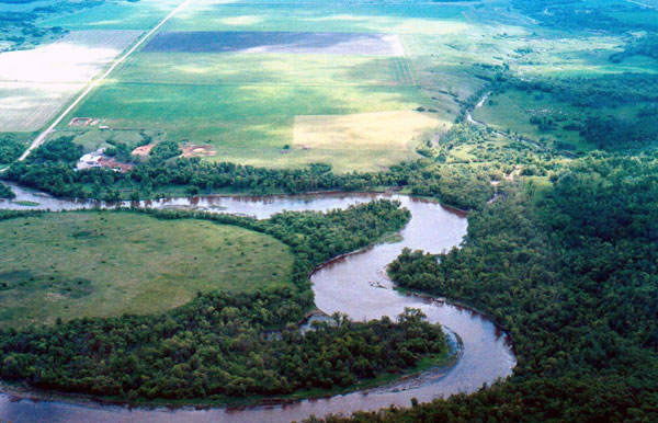
Then, as now, a river tends to grow weary
of it's course and take every opportunity to strike a new one. They
erode the outer banks until a new path of least resistance opens and
the water follows. But in this case more powerful forces were at play.
The speed of the earth's rebounding crust finally overtook the stream's
effort to entrench itself and it found it's path blocked, or rather, it
found an alternate route. It was "captured" by a northward bound
tributary of the Assiniboine, and abandoned it's ancient spillway at a
point called the Souris Bend or the Souris Elbow of Capture, just north
of present day Margaret. |