|
The
Assiniboine River / Route #4 / Brandon to
Treesbank |
 |
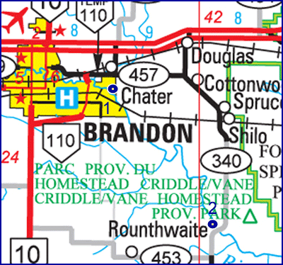
Launch : Drive straight east
on Richmond. Avenue, the road ends
at the river.
Landing : Drive east to Shilo
and south to the new Treesbank Bridge on Road #340.
Distance : About 40 km
Time : 4 - 5 Hours
See
Google Earth View
|
 |
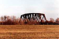
Shortly after embarking you pass
under
under a beautiful old railway bridge.
The Brandon Rapids begin shortly.
They are not difficult but watch for rocks. If the water is low, keep
to the right. Soon the banks become steep and you observe more wildlife
as you get away from Brandon. Turtles and deer are plentiful, and the
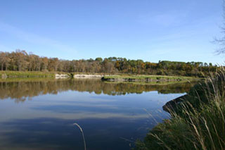
occasional eagle makes an appearance. Wiggle (or Waggle) Springs enters
on the left bank. This was a popular picnic/swimming spot in the days
before longer trips to the big resorts like Clear Lake became viable. |

Historical
Notes
This area is important historically
as the first steamboats stopped at the bottom of the rapids, being
unable to navigate further. In times when the water was high, boats
ascended by means of burying a log in the bank, (a "dead man"), with a
rope secured to it, and pulling the boat through. This took up to 14
hours, and many passengers would get off and walk to Grand Valley or
Brandon, and wait for their luggage there.
William Currie established a landing,
warehouse and ferry at the bottom of the rapids in 1880. The steamboats
ran only until 1885, but the ferry was still in operation in 1892.
Little evidence exists of the location on the north side (1-10-18),
about a mile downstream from the old railway bridge. The history is
well covered in the Cornwallis History, and in "False
Starts : Settlement Stories From Westman"
The Hudson Bay Company operated several fur
trading forts in southern Manitoba. A post called Brandon House existed
at at least three separate locations along the Assiniboine between the
Souris mouth and the Brandon Rapids. Forts tended to not last long, if
they weren't destroyed by enemies they were often burned by accident.
The third version of Brandon House was located in the vicinity of
(Wiggle) Waggle Springs at NW 29-9-17 in 1828. A cairn erected by the
Brandon Rotary Club in 1928 marks the spot.
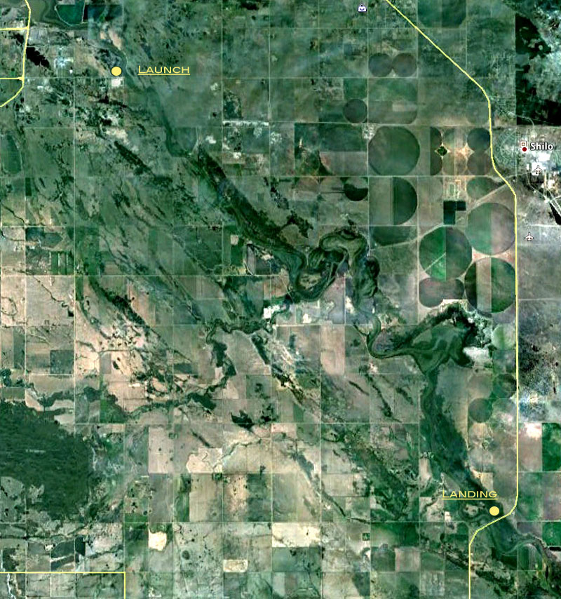
As many as five fur trade forts existed
withing range of this photo. Brandon House #1 was located in the
clearing north of the river. Mair's (Five
Mile) Creek enters from the south west about centre. The Northwest Co,
the XY Co. and Independant Traders each had forts on that side.
For More Details...
False Starts: A Settlement History of Western Manitoba
Google
Earth View
|